What Does A Topographic Survey Show?
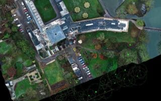
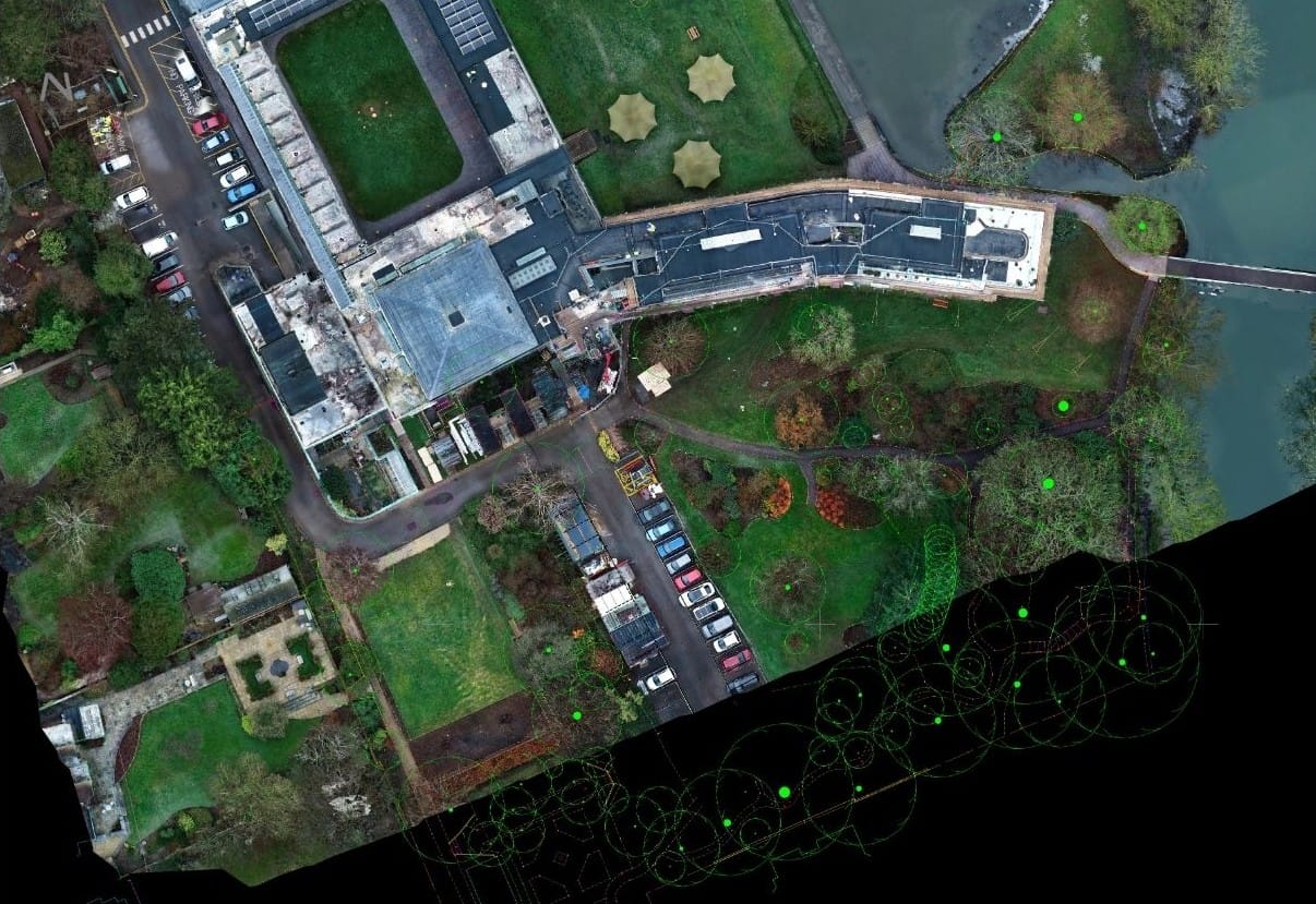
What Does A Topographic Survey Show? What is a Topographical Survey? A topographic survey, often known [...]
What Does A Topographic Survey Show? What is a Topographical Survey? A topographic survey, often known [...]
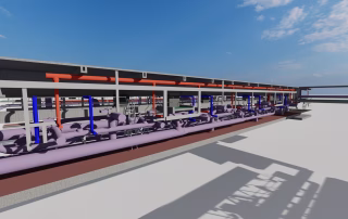
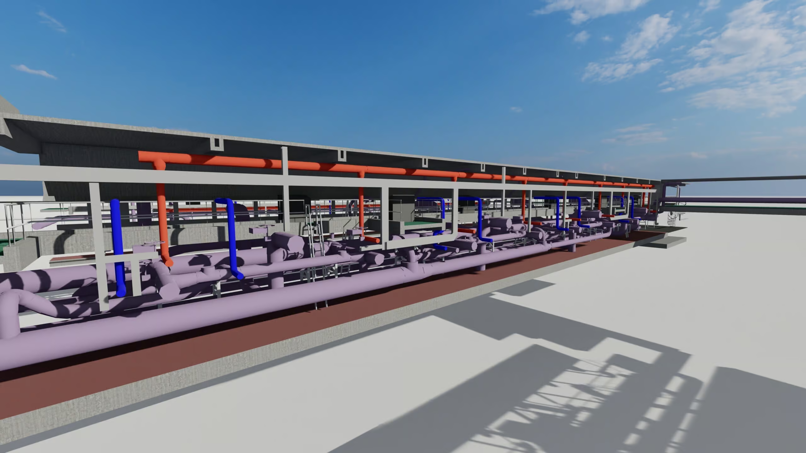
Why Accurate Site, Structure, and Service Data is Essential for Project Success > Beginning a new [...]
Laser Surveys Ltd
Open Space
Upper Interfields
Malvern
Worcestershire
WR14 1UT
Call: 01886 833173
Email: worcester@lasersurveys.com
Laser Surveys Ltd
The Old Dairy
Stubbers Farm
Blackmore
Essex
CM4 0NX
Call: 01277 821555
Email: london@lasersurveys.com
We work all over the UK as well as the below locations:
North East · North West · Yorkshire & the Humber · East Midlands · West Midlands · East of England · South East · South West · Greater London · Wales · Scotland
Worcestershire
Herefordshire
Gloucestershire
Cheltenham
Redditch
Birmingham
Bromsgrove
Coventry
Shropshire
Staffordshire
Bristol
Warwickshire
West Midlands
Dudley
Solihull
Bath
Bishops Stortford
Braintree
St Albans
Essex
London
Dartford
Chatham
Chelmsford
Brentwood
Romford
Harlow
Enfield
Colchester
Enfield
Basildon
Southend on Sea
+ all other towns, cities & counties
We work all over the UK as well as the below locations:
Worcestershire
Herefordshire
Gloucestershire
Cheltenham
Redditch
Birmingham
Bromsgrove
Coventry
Shropshire
Staffordshire
Bristol
Warwickshire
West Midlands
Dudley
Solihull
Bath
Chelmsford
Brentwood
Romford
Harlow
Enfield
Colchester
Enfield
Basildon
Southend on Sea
Dartford
Chatham
Bishops Stortford
Braintree
St Albans
Essex
London
© Laser Surveys Limited 2024
Laser Surveys Ltd
Open Space
Upper Interfields
Malvern
Worcestershire
WR14 1UT
Call: 01886 833173
Email: worcester@lasersurveys.com
Laser Surveys Ltd
Old Dairy
Stubbers Farm
Blackmore
Essex
CM4 0NX
Call: 01277 821555
Email: london@lasersurveys.com
We work all over the UK as well as the below locations:
Worcestershire
Herefordshire
Gloucestershire
Cheltenham
Redditch
Birmingham
Bromsgrove
Coventry
Shropshire
Staffordshire
Bristol
Warwickshire
West Midlands
Dudley
Solihull
Bath
Bishops Stortford
Braintree
St Albans
Essex
London
Dartford
Chatham
Chelmsford
Brentwood
Romford
Harlow
Enfield
Colchester
Enfield
Basildon
Southend on Sea
© Laser Surveys Limited 2024