Drone Surveys
Using the latest drones/UAVs, we are now capable of remote data-capture in previously inaccessible areas, allowing us to provide an even more comprehensive dataset to our clients.
Desktop Utility Record Searches
Do you have a project we can help with?
Drone Survey
By employing our cutting-edge aerial mapping drone surveying technology, we can now capture comprehensive data from above.
We are pleased to announce that Laser Surveys is now undertaking Drone Surveys in the UK (UAS/UAV). Using the latest drones, we are capable of remote data-capture in areas previously inaccessible due to logistical and H&S reasons, allowing us to provide an even more comprehensive deliverable/dataset to our clients.
With our in-house CAA qualified drone survey operators, we can cover the United Kingdom conducting drone surveys on both building and terrestrial projects, capturing high accuracy levels of data efficiently, effectively and most importantly, safely while undertaking UAV land surveying.

More Details
Drone Capture with Topographical Overlay
There’s significant potential in leveraging UAV/Drone image capture to enhance traditional survey methods. For instance, here’s a topographical survey of a brownfield site overlaid on UAV imagery. The survey includes adjacent footpaths and accurately calculates volumes of earth stockpiles onsite.

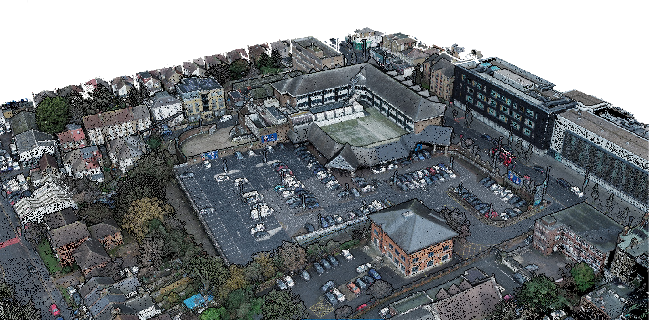
Point Clouds direct from Drone Capture
Using a drone derived point cloud can provide a cost-effective solution for hard-to-reach places and covering a vast area with a rapid turnaround. This offers another solution to our on-site survey services for large and small projects such as adding roof details that would otherwise be impossible to see from the ground level.
Which types of deliverables can I expect from a Drone Survey?

We’d love to hear from you. Get in touch to find out more
Why choose Laser Surveys as your Survey partner
Our Core Values
We Generate Results for Our Customers

“I have used Laser surveys on two projects in the health sector. I found them to offer a professional, reliable and prompt service.
The site surveyors were polite and minimally intrusive and the admin team was very amenable and always willing to help, even when our requests were quite challenging!
All in all a very customer-focused, professional service.”
 Sarah Haider - NHS
“On behalf of our Client and Project Team, we are so grateful for the level of service you have provided. Please be assured you will be considered for all further surveys.”
 Ian George - Airey Miller CM
