Why Accurate Site, Structure, and Service Data is Essential for Project Success >
Beginning a new Project can be exciting: assessing the site, understanding the client’s requirements and vision, and exploring design solutions that can work best for all these elements. Once the project has been defined and we move onto the brief and design development you will need to consider in more detail the existing site.
To consider the existing site is essential.
At this stage it is essential. Especially in terms of the terrain, location, relation to neighbouring properties and any existing structures. It will impact significantly on the way your project integrates with the existing site, and structures, as well as having a direct influence on the Projects’ spatial coordination and layout.
If we do not get sufficient information … it can lead to issues
Without sufficient information regarding existing conditions at this early stage it can lead to a range of issues such as:
Here to help >
This may seem overwhelming but here at Laser Surveys we can help provide solutions for collating your site data at an early stage in the design, to ensure you can limit the possibility of these issues arising. We can provide a range of surveys to cover all the elements required, all under one roof, meaning a cohesive and efficient approach to aid in your design development and successful project completion.
Site
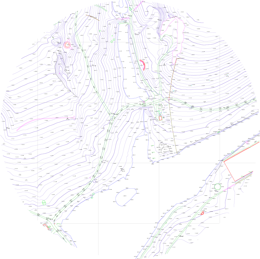
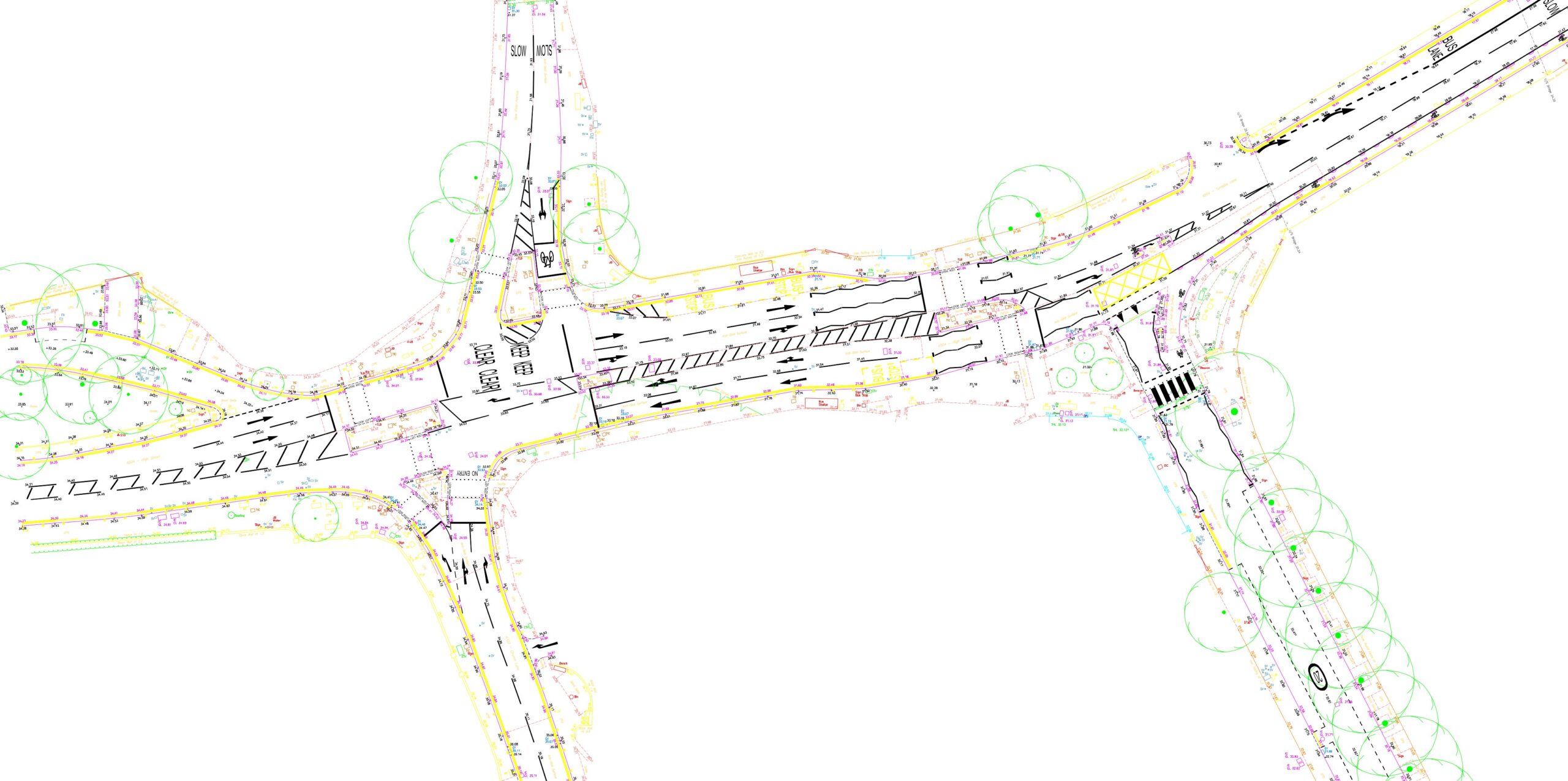
We can carry out site surveys including full topographical surveys in 2D and 3D, land registry surveys, drone surveys and photographic records. We utilise the latest data capture techniques to efficiently record all necessary site features (tailored to your needs) such as boundary details, level changes, trees, road markings and surface finishes. This results in an accurate digital plan of the site which we can provide in a range of useful formats.

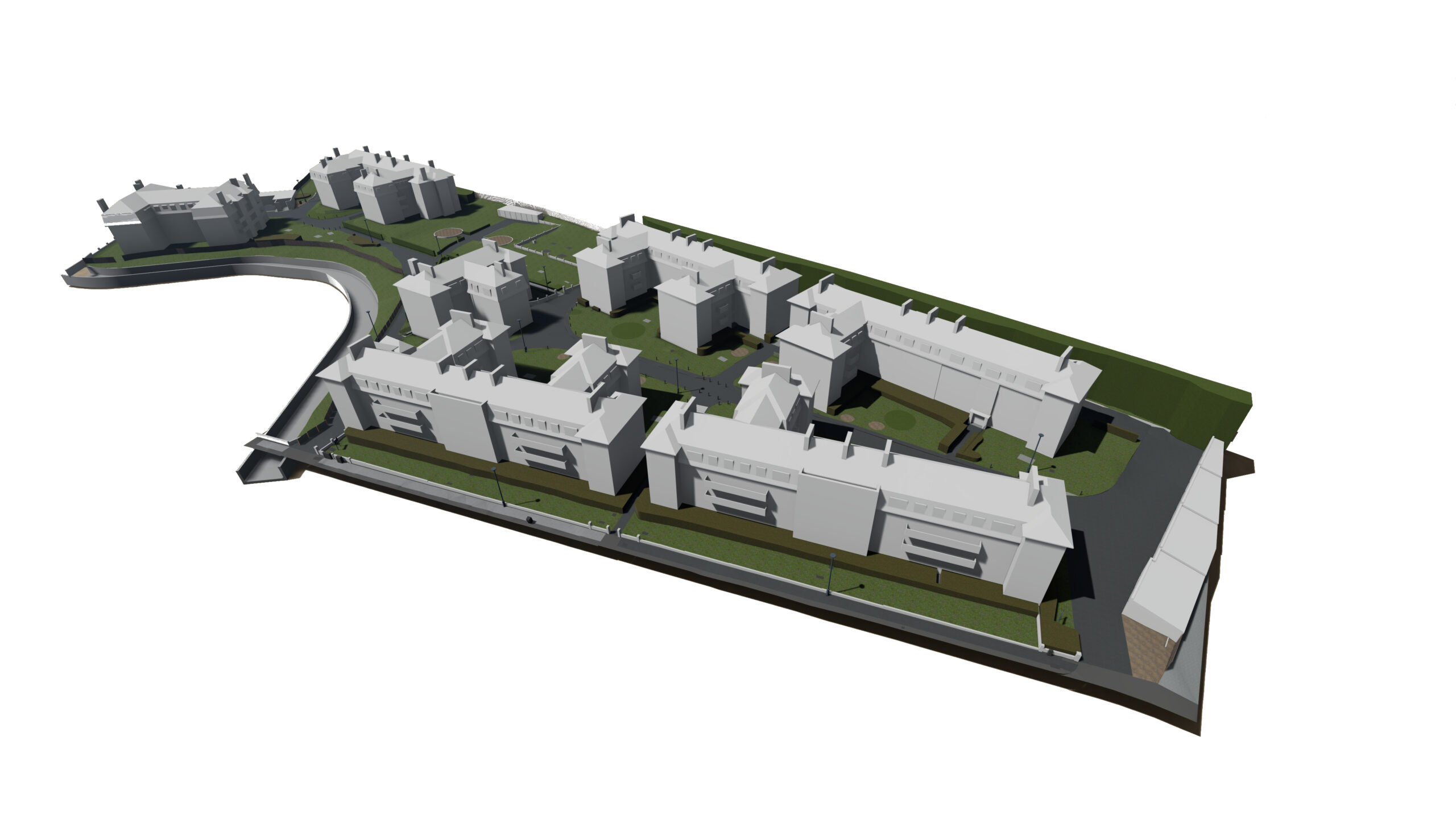
Structure
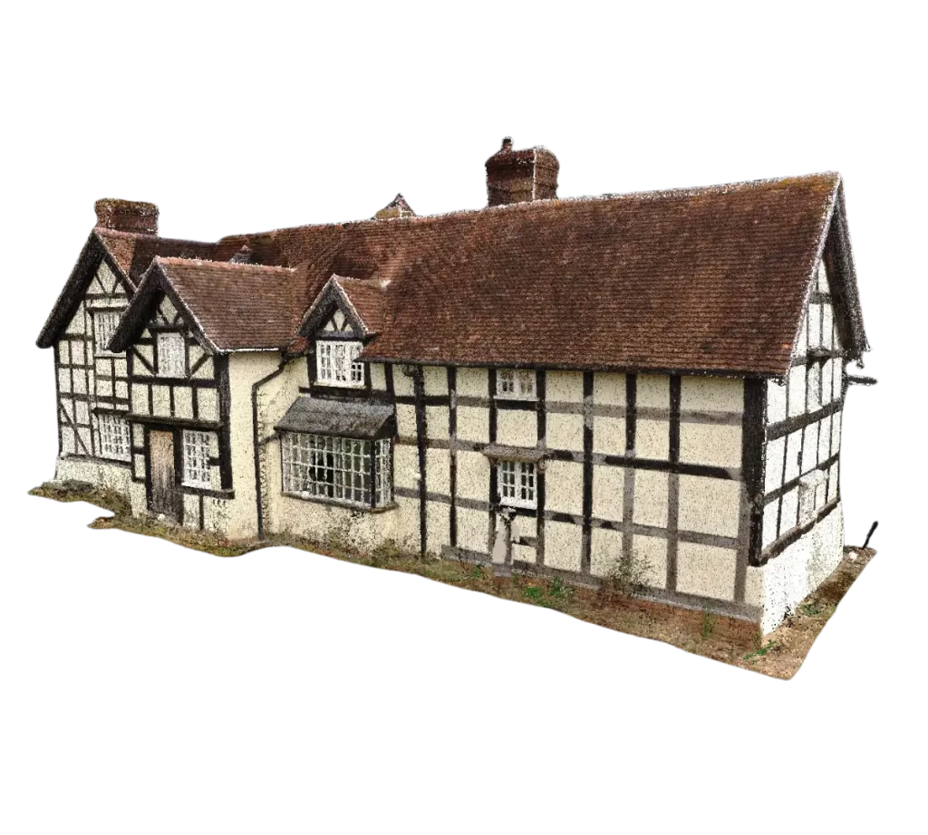
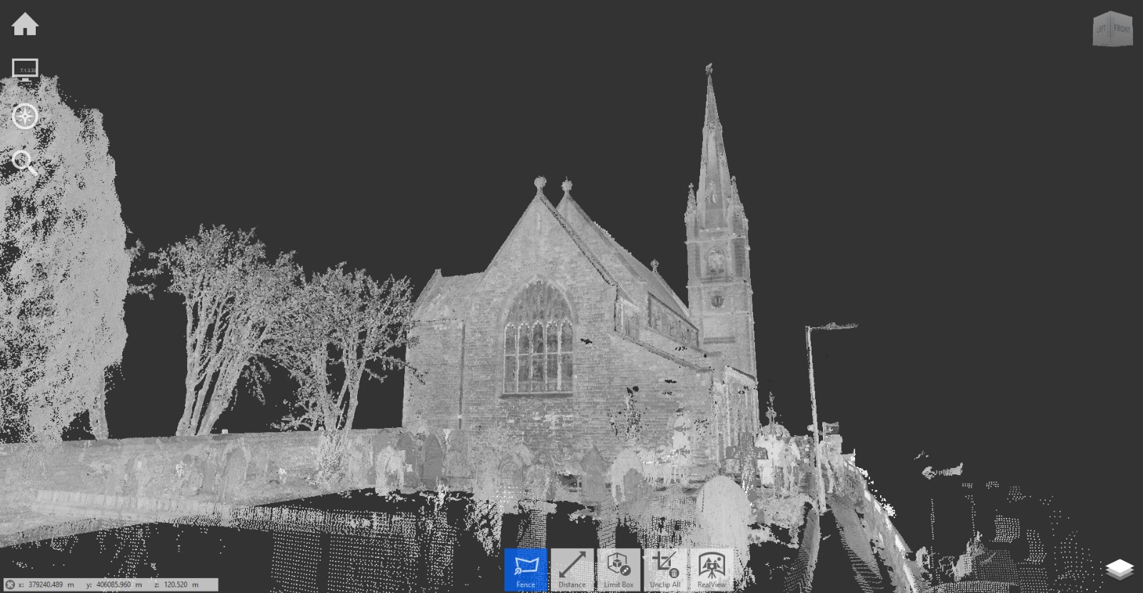
We can record the existing structures on site, including but not limited to buildings in use, disused buildings, industrial structures, stores and outbuildings, bridges, aqueducts, substations and follies. These can be recorded using a range of methods, most predominately via terrestrial laser scanning, with additional manual taping and drone surveys to complete any data sets.

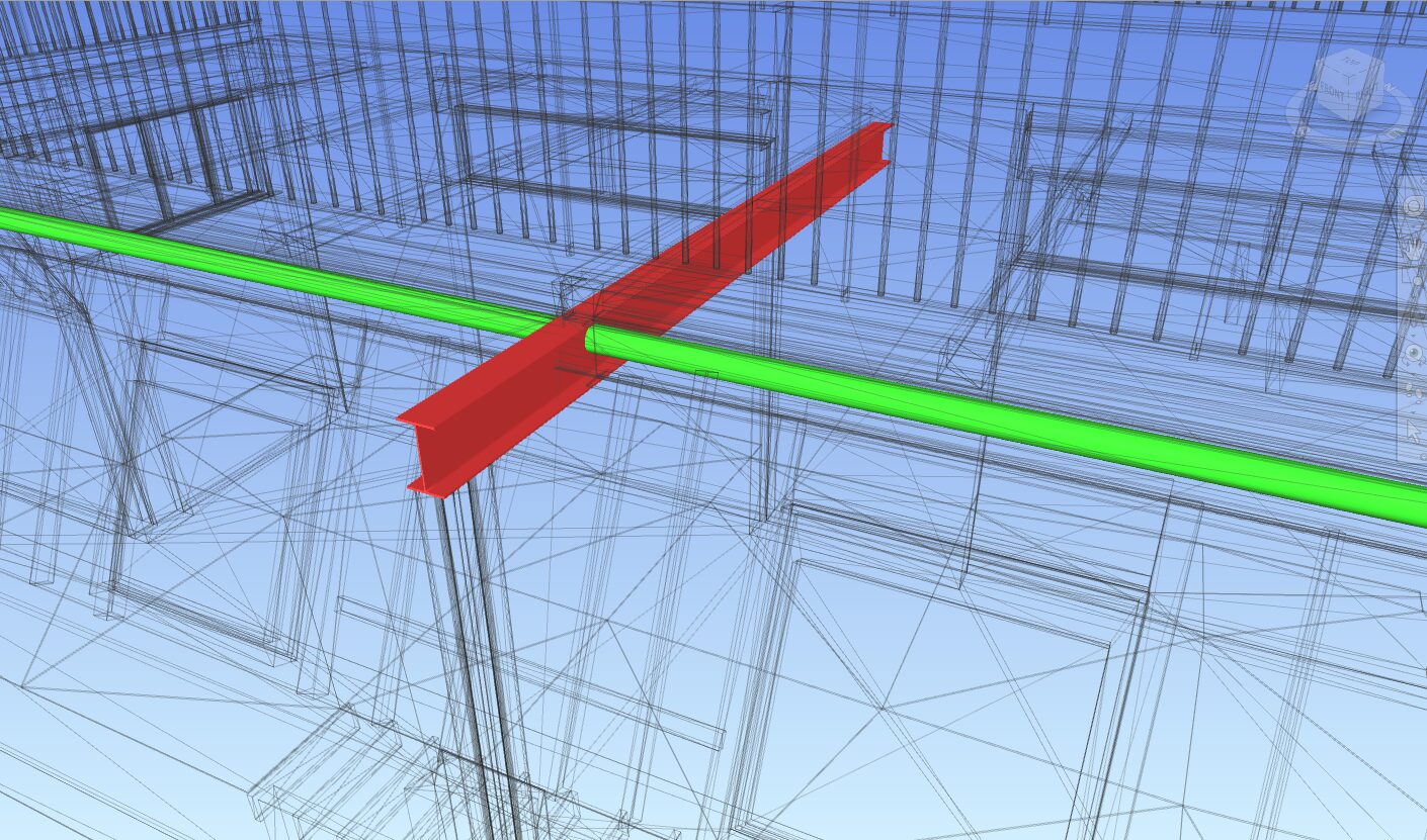
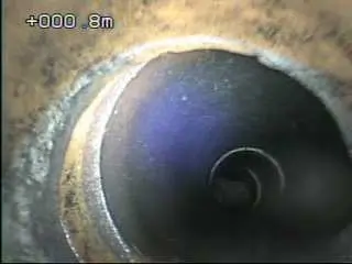
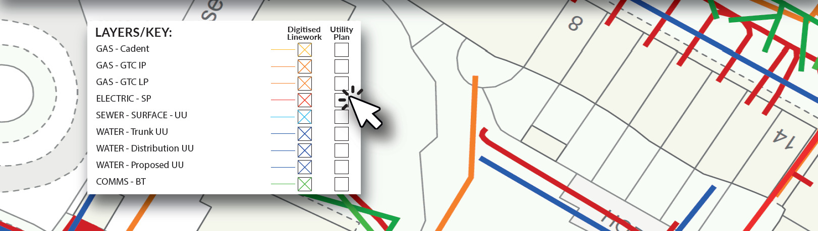
Services
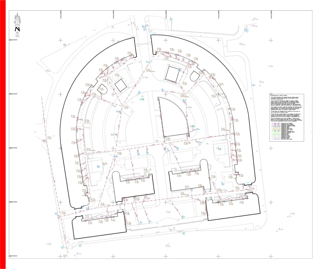
Above and below ground services are a key part of understanding any new site. They can affect every element of the design so having a clear and detailed understanding of what and where they are is essential. We can gather all this data through a combination of laser scanning, ground penetrating radar (GPR Survey), electromagnetic location (EML), acoustic / dye testing, CCTV drainage surveys and desktop utility record searches. All our Utility detection techniques (as with our building and land surveying techniques) are non-intrusive, as well as adhering to PAS128:2022.
Other Services
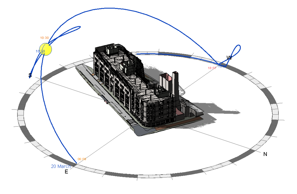
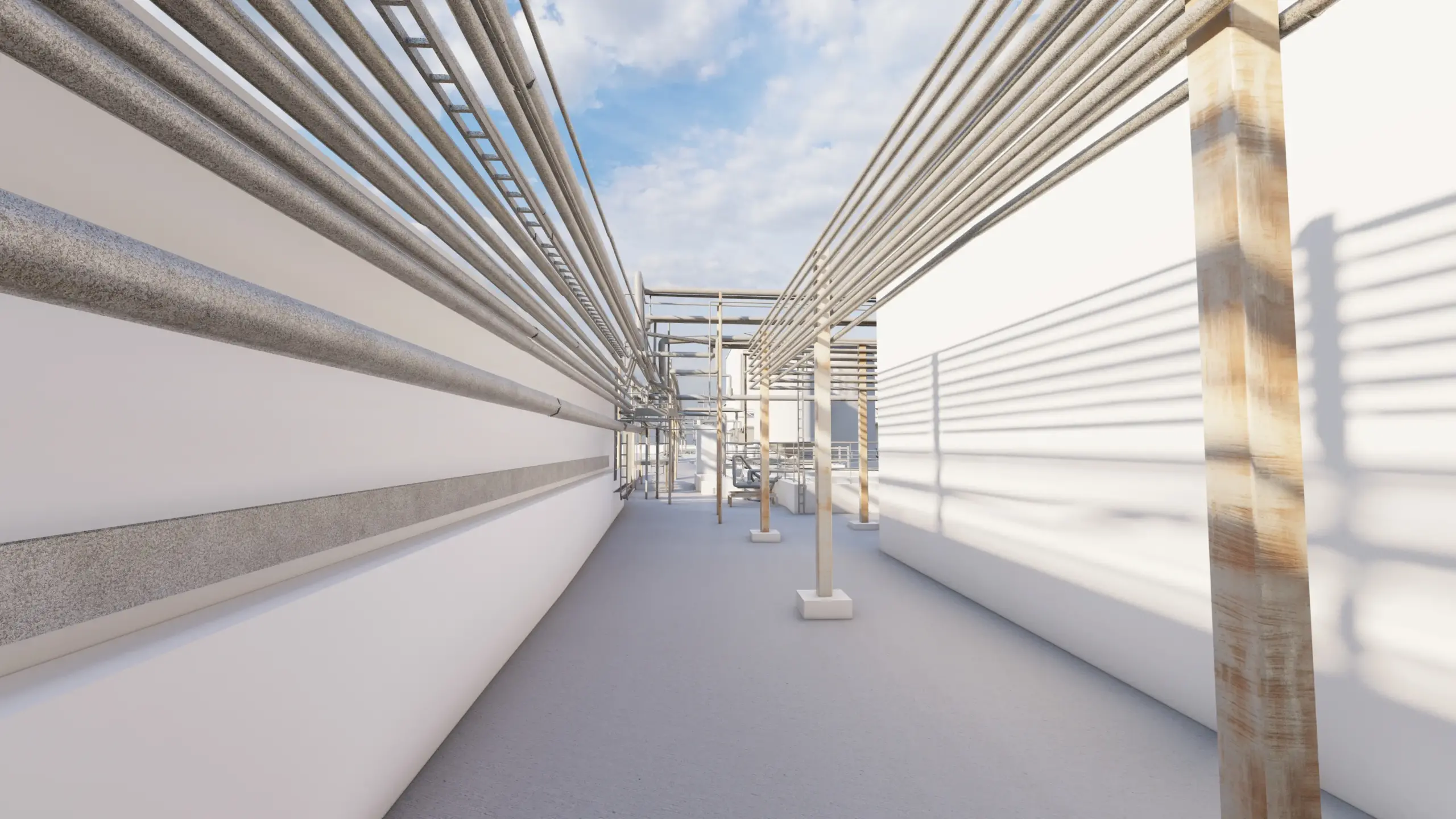
In addition to the surveys, we can provide a range of supporting services to assist in your project development. These include solar studies using a 3D model of your site and existing structures, converting your 2D design to 3D to help visualise the project as designed and area measurement surveys with options including NIA, GIA and GEA surveys.

What you’ll get >
We can provide your survey data in a range of formats to suit your project needs. Whether that’s in 2D/3D CAD, 3D models, photos or videos, or a combination of outputs, we have an option that will work for you. We can even combine the data from any and all the site surveys we carry out into one streamlined BIM-ready survey model to centralise and organize your project right from the outset.
Summary >
In summary, a good project starts with good foundations, both physically and conceptually. At Laser Surveys we can assist in providing that solid foundation to enable the smooth, clear and efficient workflow required for you. Get in touch with us now to discuss exactly what you need for from your existing site, structures and services for a successful project.