Case Study
Deep Entry Sewer Alignment Survey – Harrow, London
Deep Entry Sewer Alignment Survey – Harrow, London
Requirements and Logistical Issues
We were asked to provide a line and level survey of a Thames Water Trunk Sewer that passed diagonally under the proposed development site. The logistics of the operation were complex due to a number of reasons – the first being the access points within the middle of the highway – and the second being the depth of the pipe which was circa 15m deep.
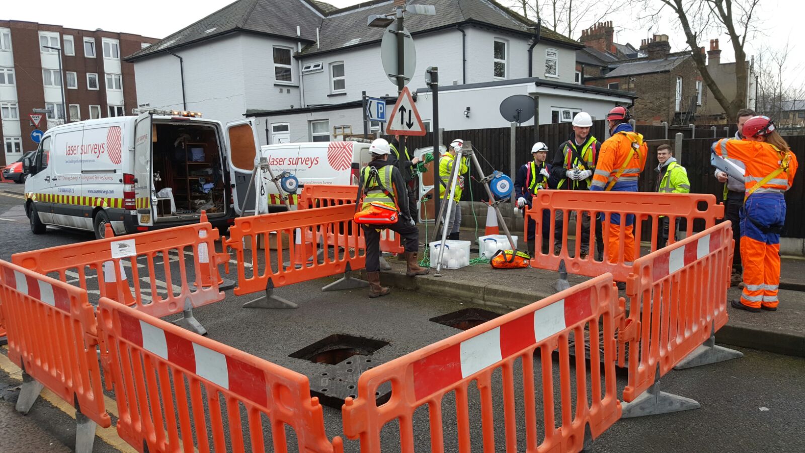
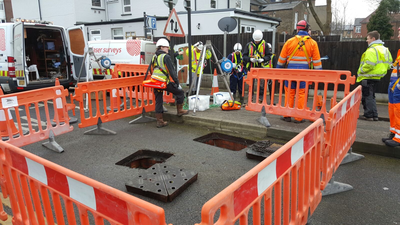
Pre-survey H&S and logistics works
We carried out the initial reconnaissance visit to check the logistics of the operation and to provide us with the necessary information required to produce the methodologies, risk assessments and safe systems of work for the man-entry visit. Having this information allowed us to then contact Thames Water and arrange necessary permits. Due to the depth and access points we had to subcontract an emergency rescue team from BA Safety and traffic management involving a full road closure arranged by Shift Traffic Management.
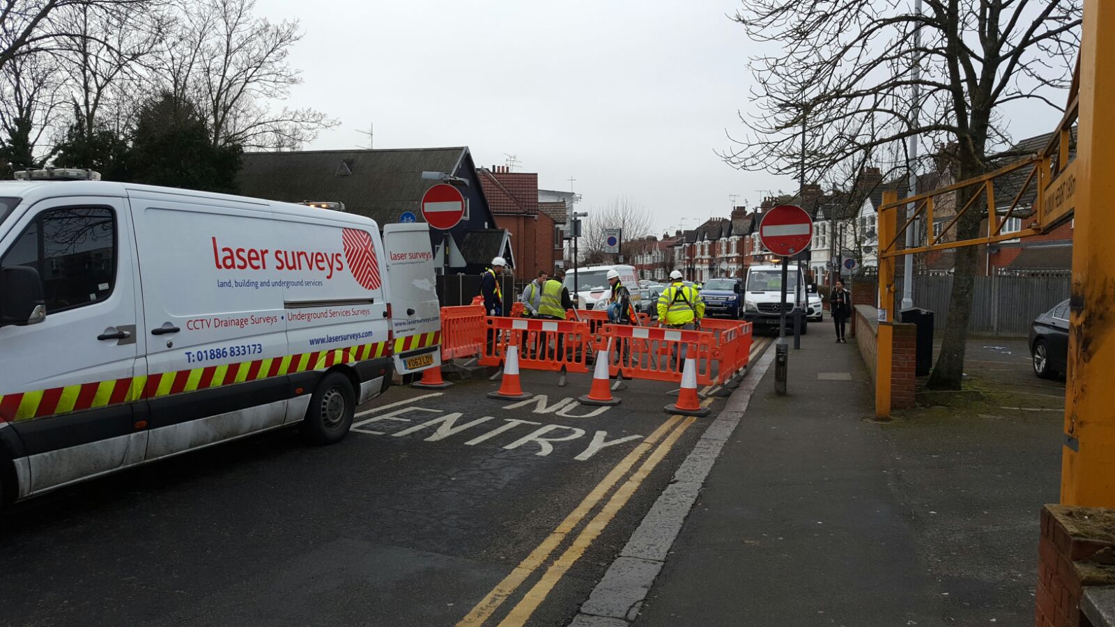
Survey Visit – liaison with traffic management crews and H&S provision
It was decided by the local authorities that the works must take place between the hours of 10am and 2pm to avoid causing major disruptions to the local traffic. We decided to arrive shortly after 9:00am so that we could brief all teams involved to make sure everyone was aware of the methodologies and logistics of the task at hand and get the site setup ready for 10am so we could make the most of the restricted working hours.
Once the site had safety been set up and traffic diverted the safety gear was set up allowing us to deploy our multi-skilled survey teams which consisted of Surveyors equipped with 3D FARO Laser Scanners (used to scan the internal dimensions of the trunk sewer system) and Underground surveyors equipped with recording devices (used to check the condition and record any defects). The site visit was successful and the data retrieved from the site covered all requirements set out by our client allowing them to move forward with the planning application.
Final Survey Information
Deploying the 3D FARO Laser Scanners allowed us to produce a 3D point cloud which we could then use to retrieve the line and level information.
Due to the diameter of the pipe we were unable to deploy our normal CCTV crawler systems – instead, we conducted a ‘walk-through’ survey recording the footage/images on a hand held recording device.


Requirements and Logistical Issues
We were asked to provide a line and level survey of a Thames Water Trunk Sewer that passed diagonally under the proposed development site. The logistics of the operation were complex due to a number of reasons – the first being the access points within the middle of the highway – and the second being the depth of the pipe which was circa 15m deep.
Pre-survey H&S and logistics works
We carried out the initial reconnaissance visit to check the logistics of the operation and to provide us with the necessary information required to produce the methodologies, risk assessments and safe systems of work for the man-entry visit. Having this information allowed us to then contact Thames Water and arrange necessary permits. Due to the depth and access points we had to subcontract an emergency rescue team from BA Safety and traffic management involving a full road closure arranged by Shift Traffic Management.
Survey Visit – liaison with traffic management crews and H&S provision
It was decided by the local authorities that the works must take place between the hours of 10am and 2pm to avoid causing major disruptions to the local traffic. We decided to arrive shortly after 9:00am so that we could brief all teams involved to make sure everyone was aware of the methodologies and logistics of the task at hand and get the site setup ready for 10am so we could make the most of the restricted working hours.
Once the site had safety been set up and traffic diverted the safety gear was set up allowing us to deploy our multi-skilled survey teams which consisted of Surveyors equipped with 3D FARO Laser Scanners (used to scan the internal dimensions of the trunk sewer system) and Underground surveyors equipped with recording devices (used to check the condition and record any defects). The site visit was successful and the data retrieved from the site covered all requirements set out by our client allowing them to move forward with the planning application.
Final Survey Information
Deploying the 3D FARO Laser Scanners allowed us to produce a 3D point cloud which we could then use to retrieve the line and level information.
Due to the diameter of the pipe we were unable to deploy our normal CCTV crawler systems – instead, we conducted a ‘walk-through’ survey recording the footage/images on a hand held recording device.
Why use Laser Surveys?
- We cover all sites – residential, commercial and industrial.
- Pipe sizes ranging from 100mm up to trunk sewers (3m diameter in this case).
- Build over applications (pre and post-construction).
- High-pressure jetting using lorry-mounted combination units.
- Full range of H&S accreditations including confined space certification.
What deliverables can be provided?
- Survey accurate information supplied on a coordinated 2D AutoCAD layout plan. Our works can be related to and incorporated into existing survey schemes.
- PDF Wincan report giving you a detailed breakdown of each drainage run with its position easily located on the cross-referenced layout plan.
- Key photographs and descriptions of defects.
- Full video footage supplied on DVD.
- Share CCTV project information seamlessly with your colleagues with our latest WinCan data-viewing portal.